Mesoscale modeling, a computationally advanced methodology for wind-flow modeling, is used in the wind energy industry to provide statistically accurate spatial variance of wind characteristics across a given area and to reduce the uncertainty of energy yield estimates.
ArcVera’s mesoscale modeling methodology uses the Weather Research and Forecasting (WRF) model at high resolution or a large-eddy (LE) version and downscaling to a 30-m terrain wind map resolution. Creating a long-term mean annual hub-height wind map makes the resulting output appear similar to computational fluid dynamics (CFD) and commercially available linear wind-flow models (such as WAsP).
However, CFD and linear wind-flow models do not include the requisite physics to accurately simulate natural weather characteristics, such as time-varying weather, atmospheric stability, differential solar heating, soil moisture, phase changes of water, and precipitation.
Unlike other models, Mesoscale models do not require on-site meteorological tower information to produce a high-resolution wind map with accurate wind speed-up ratios (wind map patterns). Instead, they use long-term reanalysis data to simulate the natural weather and site-specific wind speed gradients in the domain. After creating the wind map, these patterns can be bias-corrected to long-term mean annual wind speed estimates from a project’s on-site wind measurements.
The wind energy industry uses the results of these simulations to accurately estimate the long-term wind patterns across a project. This isrelevant to the critical impact of turbine placement on array aggregate wind speed, thereby increasing the accuracy of annual wind energy estimates.
Mesoscale modeling techniques for bankable studies provide distinct and high project value from prospecting through development and financing by reducing the uncertainty in the wind map and energy production. Development-stage business decisions are more accurate and financially efficient.
Reduced Uncertainty for Competitive Financing
For wind energy development, high-resolution (200-m or 300-m grid spacing, downscaled to 30-m wind map terrain resolution) mesoscale modeling reduces the uncertainty of energy yield estimates relative to not using this method or when compared to other types of wind-flow modeling especially in complex terrain.
From a financial modeling point of view, the practical effect is that this uncertainty reduction increases the megawatt-hours of energy production associated with given probabilities of exceedance (P-Values), typically used for sizing financial modeling scenarios and stress tests, bringing them closer to the expected mean long-term production estimates. In short, the high-resolution mesoscale modeling method employed by ArcVera Renewables brings P90 closer to P50 and P99 closer to P50.
The benefits of this reduction are twofold: i. A tighter PXX/P50 ratio increases cash available for debt service/preferred distributions, which increases the project’s debt/quasi-debt capacity; and ii. It reduces the actual as well as the perceived production risk.
The latter is particularly important for projects that aim to undergo a credit rating process for their project-level debt Noting FitchRating’s Renewable Energy Project Rating Criteria, higher P90/P50 ratios align with better credit risk assessments. With this increased third-party funding capacity, the bidder could either reap increased IRR for the same price, reduce the price while preserving IRR, or a composite of the two.
Fortunately, the value of accurately modeling the wind flow for a wind energy project can be quantified by its effect on a project’s modeled returns, as quantified by the IRR. To keep the analysis market agnostic, inputs such as capital expenses (CAPEX), operating expenses (OPEX), and revenue will be provided in generic units of currency with a focus on ratios (such as EBITDA margin) rather than absolute numbers.
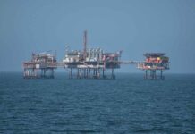
Mesoscale Modeling for Offshore Wind Energy Projects
The lack of complex terrain in the offshore environment may intuitively steer project developers away from mesoscale modeling to assess the project’s wind energy resource. However, compelling technical reasons indicate that this is not the right course of action.
The absence of underlying topography and land surface variability in the offshore environment doesn’t preclude the applicability of mesoscale modeling.
Three critical aspects of the marine environment for which mesoscale modeling offers unique capabilities that lower the uncertainty of wind resource and site suitability estimates in the offshore environment: the stability of the marine environment, the uniqueness of the coastal zone, and the storm track.
Overland, the diurnal cycle of solar heating and nocturnal radiative cooling of the land surface produces large daily oscillations in atmospheric stability, especially in the warm season. Unlike onshore, offshore diurnal heating and cooling are muted. Yet, stability can vary significantly if the air flowing over the sea is notably warmer or colder than the sea surface temperature. The atmospheric research community has designed mesoscale models to represent air-sea energy exchange processes and marine boundary layers properly and have long been used to predict the weather over both land and sea.
Offshore wind is economically more feasible when the depth is relatively shallow, a constraint that often focuses on development nearshore rather than over the open ocean. This coastal zone environment is unique because its meteorology constantly transitions, with air streams adjusting to the abrupt change in underlying surface roughness, heating, and moisture. A ubiquitous feature is a significant mean wind speed gradient from the coast extending tens of kilometers offshore, with lower speeds nearer the coast. With the high cost of offshore wind measurement campaigns, often only one measurement site is deployed within the project area, which is insufficient to establish this gradient observationally.
Many regions of offshore wind development are within, or on the flanks of, a “storm track”, or a region where large-scale weather systems (low-pressure centers and fronts) repeatedly develop and pass through. A storm track can superimpose another gradient in mean wind speed on the project site. Because mesoscale models include all the physical processes that affect the life cycles of such weather systems, a climatology built from retrospective mesoscale model simulations will typically quantify the storm track accurately.
The benefits of mesoscale modeling are not limited to capturing interactions of weather-induced wind flows with the underlying terrain. They also include a wide array of atmospheric processes that are key to simulating wind evolution in offshore marine environments and should be considered an essential component in the offshore wind project developer’s toolbox.
Increasing wind energy project value
Deciding to use a high-resolution mesoscale modeling technique in the early stages of wind energy development or later at financing directly increases a project’s value by creating a robust technical basis for project financing. It also allows improved business decisions to enable more financially efficient meteorological measurements, landowner targeting, and early array design optimization based on field results and constraints.
Using this high-resolution mesoscale modeling method to reduce the energy production uncertainty and thus increase the P90/P50 ratio, developers can increase the size of third-party funding by either decreasing the PPA price for an advantage in an energy auction or increasing the IRR for higher profitability.
Author: Mark Stoelinga
 Mark Stoelinga
Director of Atmospheric Modeling
Mark earned his Ph.D. in Atmospheric Sciences from the University of Washington and leads the mesoscale modeling production team at ArcVera Renewables. Mark is a strong research professional and an experienced senior scientist with a demonstrated history of success in meteorological research and applications to renewable energy. Mark is responsible for the improvement and execution of mesoscale model processing and post-processing and advancing the technical edge of ArcVera Renewables’ wind energy analysis services. Mark has published articles on high-resolution mesoscale modeling and the benefits of customized mesoscale modeling for offshore wind prospecting and development. Mark was formerly with Vaisala, a Finnish company that produces products and services for environmental and industrial measurement, where he developed new techniques for renewable energy assessment, including a reanalysis ensemble-based long-term reference model and a full-time series-based energy loss model, and produced large regional and global gridded wind energy resource datasets using a mesoscale numerical weather prediction model. Additionally, Mark conducted major validation studies of Vaisala’s wind energy assessment method, wind wake loss model, and remote sensing devices. He significantly contributed to US Department of Energy-funded research studies (Wind Toolkit Project, Wind Forecast Improvement Project 2, and Solar Forecasting 2 Project). He has served on industry standards and project committees (IEC, CFARS, AWAKEN, WFIP3).


